Our Monday Insights video takes you behind the scenes of the forecast—with a closer look at wildfire smoke, the humidity timeline, isolated thunderstorm potential, and what looks to be the beginning of a drier-than-normal August (more on that in our August monthly forecast, posting later today – check back at the homepage or atop the 1DegreeOutside Weather app!).
If you’ve noticed hazy skies or smelled smoke in the air, you’re not imagining it. Surface-based wildfire smoke from Canadian fires continues to impact air quality across New England, especially on Monday afternoon and evening. The smoke will shift Tuesday—pushing into western New England, while cleaner ocean air improves conditions in the east.
Expect more colorful – but “dirty” – sunrises and sunsets through midweek.
After Monday’s comfortable air, a brief increase in humidity is expected Tuesday with a shift to a southerly wind. This will be short-lived, as onshore easterly winds return midweek and help suppress any major moisture return through Thursday.
Each afternoon from Tuesday through Thursday, isolated inland thunderstorms will be possible – especially across northern and western New England, where daytime heating and weak boundaries help spark development. With slow movement, a spot of flash flooding is not impossible, but most storms will remain isolated.
Eastern New England and the coast should remain dry due to marine influence.
According to Matt, this week’s pattern is the start of what may be a drier-than-normal August. That’s reflected in our monthly forecast video (also released today), showing high pressure over eastern Canada limiting rain chances for much of the region.
Still, it’s important to exercise fire safety even in this relatively low-danger season. Moderate fire spread potential is expected both Monday and Tuesday—so keep an eye on fire pits, grills, and campfires.
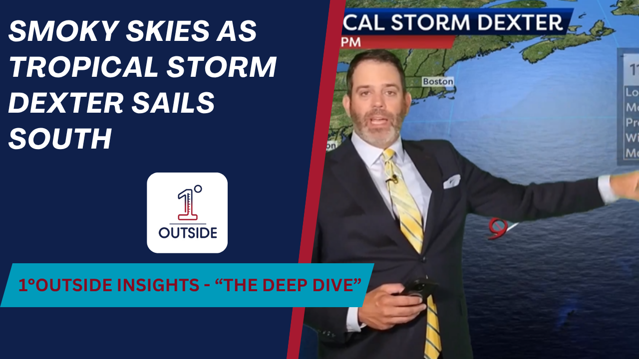
A tropical system—likely to earn the name Dexter—has formed offshore, but the jet stream winds are sweeping it safely out to sea. However, this system may send ocean swells our way, prompting a moderate to high rip current risk at east- and southeast-facing beaches this week.
Expect highs in the 80s inland and 70s along the coast through Thursday. Lows remain seasonable, mostly near 60°. Friday looks warmer, and we’ll be watching the tropics closely.
📲 Get radar, hour-by-hour forecasts, wildfire smoke tracking and more:
1DegreeOutside Weather App, available FREE on iOS & Android.
🎯 Help us grow—and power through events like last week’s cyberattack—by becoming a member:
membership.1degreeoutside.com
🧢 Want to rep the brand? Gear, mugs, and more: swag.1degreeoutside.com


