


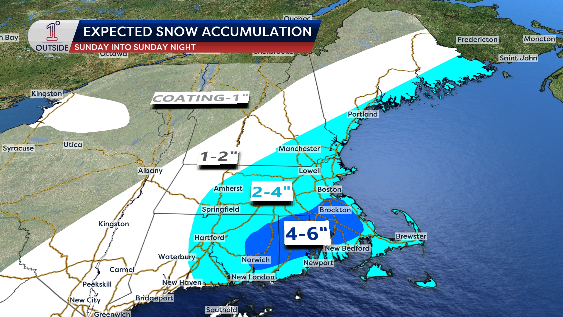
Our updated snowmap is out for Sunday’s strengthening storm, and while this one is set to track quickly southeast of New England, it will deliver widespread accumulating snow to the region. Guidance has come into a more reliable forecast window, and the trend is that models are “latching on” to additional ocean moisture, which is helping to drive totals a bit higher in the latest map.
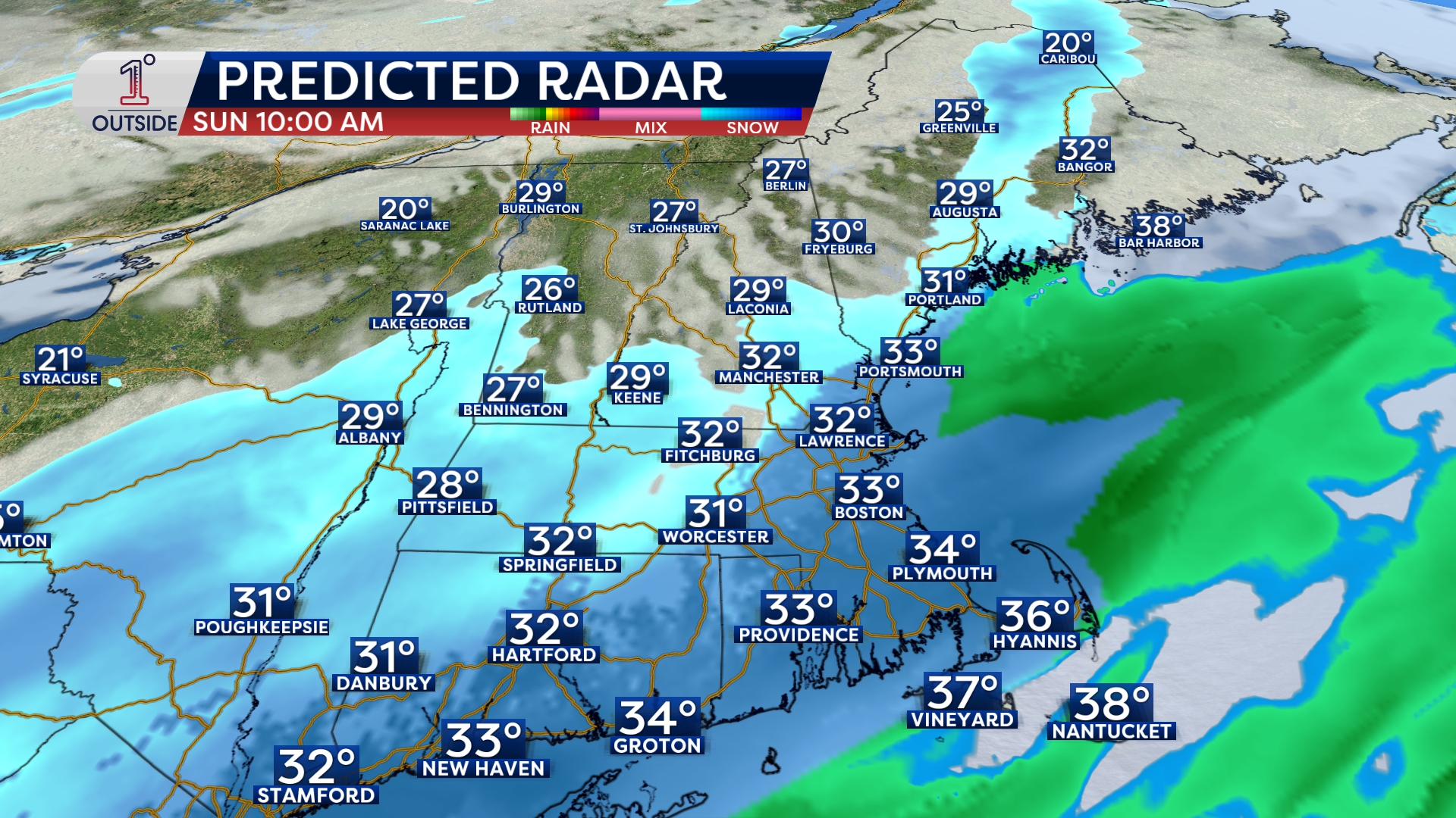
The biggest challenge remains timing. The biggest uncertainty is the transition from disorganized morning snow showers to steadier snow. Expect snow to break out during the mid to late morning and ramp up (may mix briefly at onset with rain) with the most impactful stretch from mid afternoon into the evening. Heavier snow rates between about 4 PM and 11 PM will create treacherous travel. Snow intensity will taper after that, with the back edge coming in west to east around or just after midnight.
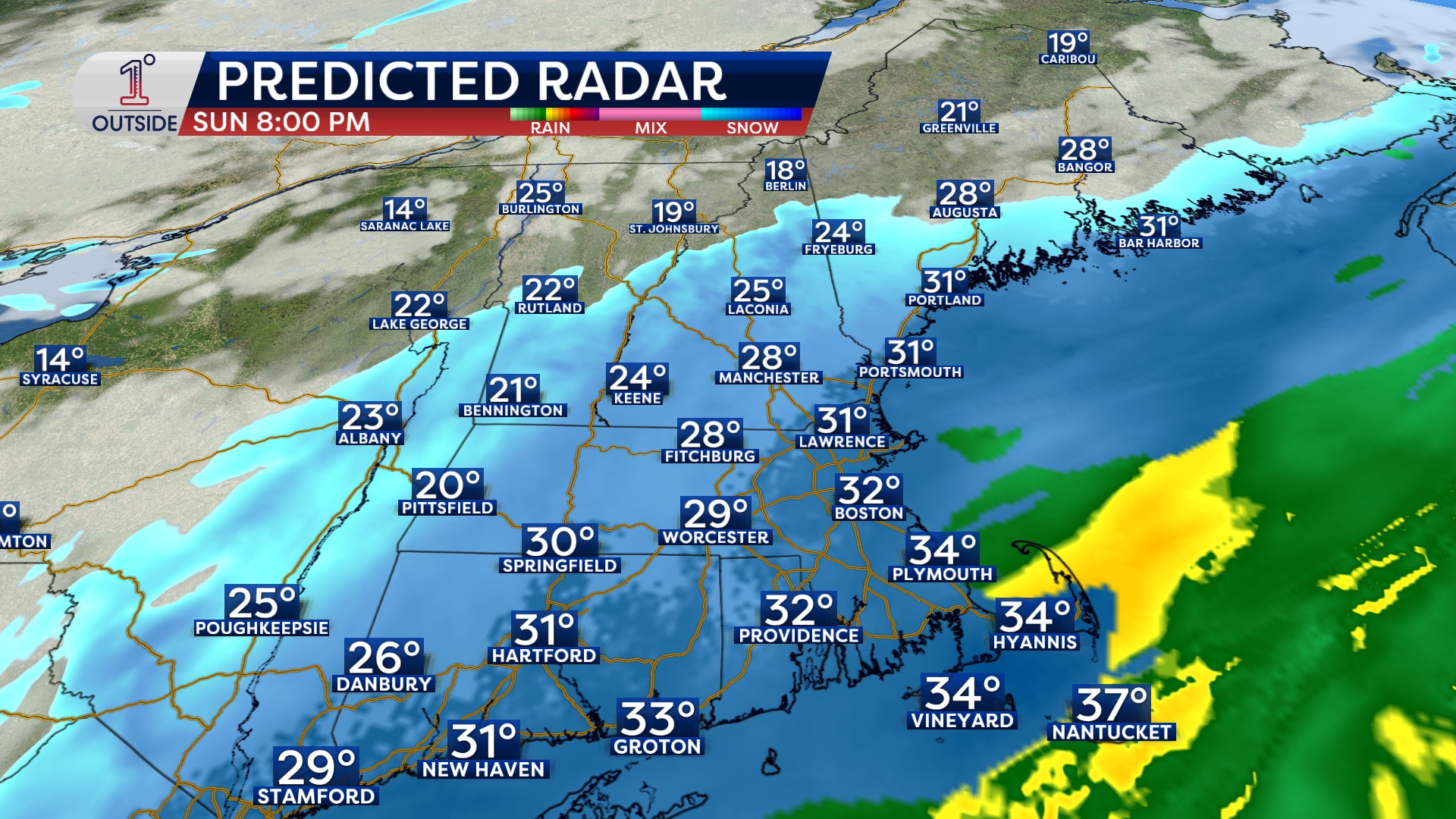
Snow quality also matters for impacts: this will be a fluffier snow through the interior anda moderately wet snow closer to the coast, which will mean more slush and packed snow on untreated roads. Add in falling temperatures Sunday night, and the post-storm concern becomes refreeze and black ice after midnight as moisture “locks in” on pavement.
Download the free, 5-star 1DegreeOutside app to follow every update.